What are you looking for?

IMPLEMENTATION - "Thinking Ahead Begins with Thinking".

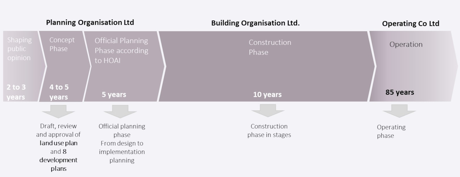
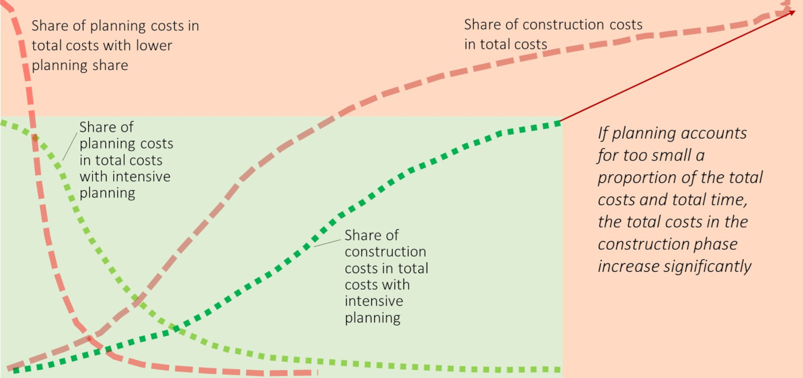
•The implementation of the Frankfurt bridges requires a detailed planning phase of 5 years, with a subsequent construction phase of about 10 years

•Both phases will be carried out by management companies with a non-profit legal form in order to be able to clearly and unalterably define the goals and details within the framework of the non-profit purpose for the next 100 years in advance for investors, the population and all the authorities and public-law bodies involved.

•The resulting planning certainty is the most important lever for adhering to the budgeted cost and time frames for the overall project.

•Even before the start of the actual planning phases in accordance with public planning law, the preparatory work required for the adoption of a separate land use plan and the 8 development plans for the bridges must be carried out within the framework of a lead time of approx. 3 years: The focus here is on the resident analyses and a detailed concept for comprehensive resident compensation.
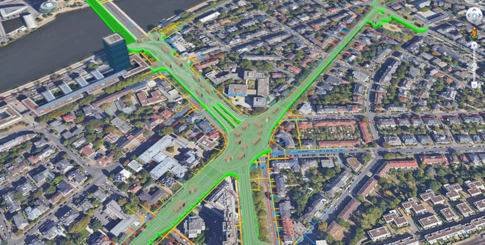
•As soon as the legal requirements for the Frankfurt bridges have been met, construction of the bridges can begin in sections, starting with the ring, followed by the most important sections for the energy and water concepts, the west and east arms. While the remaining bridge arms are still being completed, the operating company can already start operations in the sections that have been built.

The most important building block for the implementation of the Frankfurt bridges: Acceptance

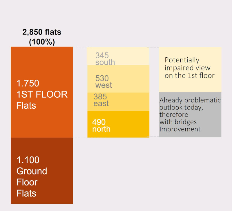
§The most important prerequisite for the implementation of the Frankfurt bridges is a thorough resident analysis, especially shading analyses for each individual building along the route. Even before the actual planning begins, a compensation plan must be developed for the building owners and residents potentially affected by the bridge construction that is attractive enough to make them the biggest winners and thus supporters of the construction project rather than disadvantaged opponents.

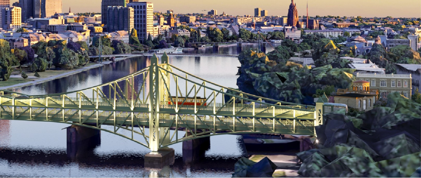
§It is important to have conceptual designs that ensure that the space under all bridge sections is bright and appealing: lighting concepts, light openings in the body of the bridge, pleasant natural sounds/music playing on lonelier bridge sections, camera surveillance - all of these should be detailed in the "apron planning" so that there is not a separation of "upstairs" and "downstairs" at the bridges, but so that the undersides of the bridges are bright, green, airy and pleasant for all people who approach them.

§There is a need to create a coalescence of above and below, through sitting stairs at the bridges, opening bridge balconies, light holes with waterfalls and the like.

§The infrastructure project "Frankfurt Bridges" can only be carried out in project cooperation with the city of Frankfurt, even if the construction is privately financed: The "City of the Future" will only come into being if all the offices and authorities involved (Planning Office, Building Office, Environmental Office, Parks Office, City Surveyor's Office, etc.) and also utilities (Mainova, VGF, NRM, SEF, etc.) are at the table during the planning phase. For the city, this means that it will have to specifically build up specialist personnel for the construction of the Frankfurt bridges, as the top performers in all of the city's offices and utility companies are already massively overworked.

Planning phase of 5 years realistic - lead time of approx. 2-3 years for public participation.

Stiftung Altes Neuland Frankfurt / GNU

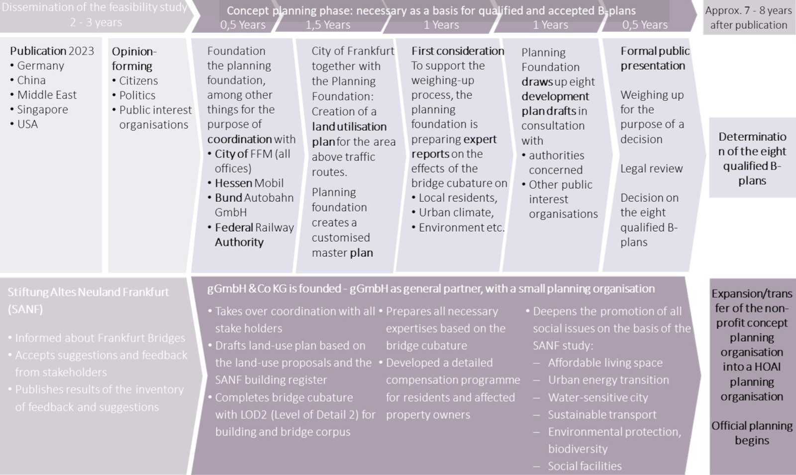
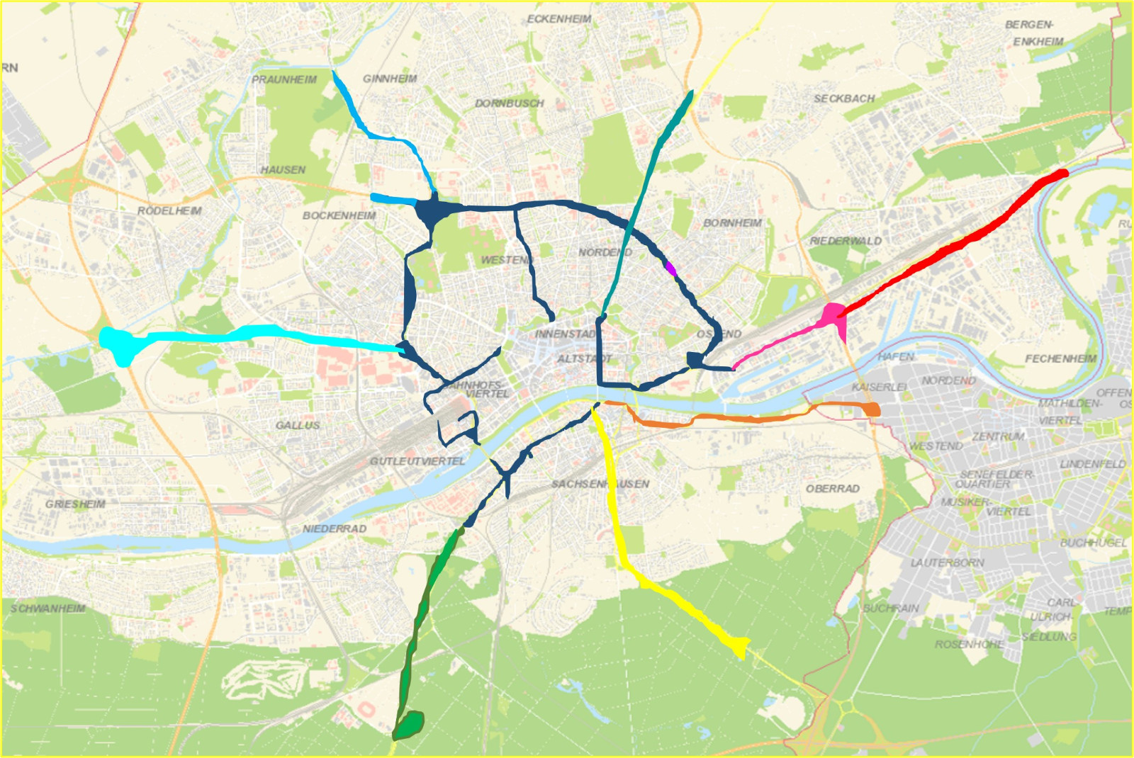
•In the two- to three-year lead time before the actual planning begins, a land use plan and eight development plans are to be developed - one for the ring road and one for each of the seven bridge arms.

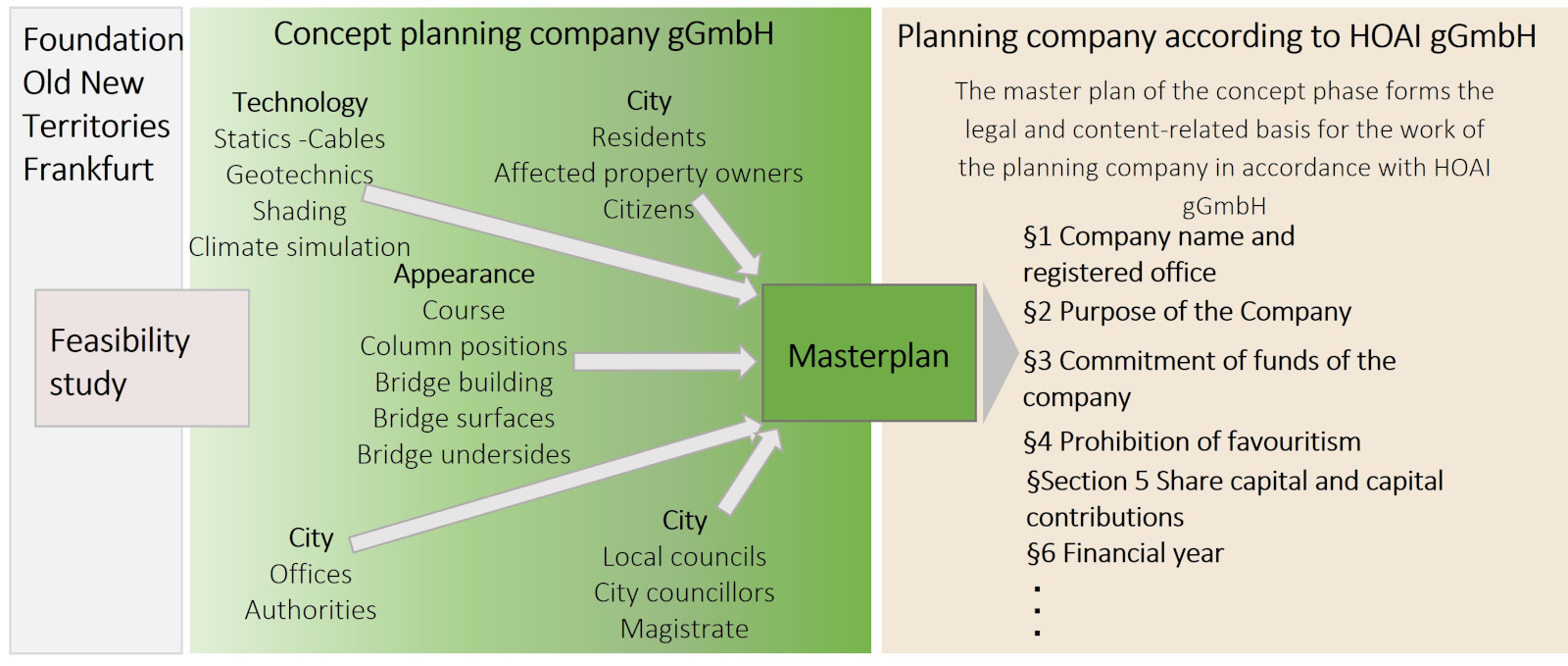
•Subsequently, the detailed 5-year planning can be carried out by a public welfare-oriented planning company. This is dedicated to the completion of the design planning, which was started within the framework of the SANF feasibility study. This is followed by the classical planning phases up to the implementation planning.

•As part of these planning phases, there is close cooperation with the relevant offices at city and state level, in the course of which extensive expert opinions and studies are prepared for all planning areas in order to make the subsequent construction phase as lean and effective as possible.

You can walk on the Frankfurt bridges in 20 years with good planning & execution

Stiftung Altes Neuland Frankfurt / GNU

To this end, land use plans and 8 development plans must be designed, reviewed by experts and coordinated.

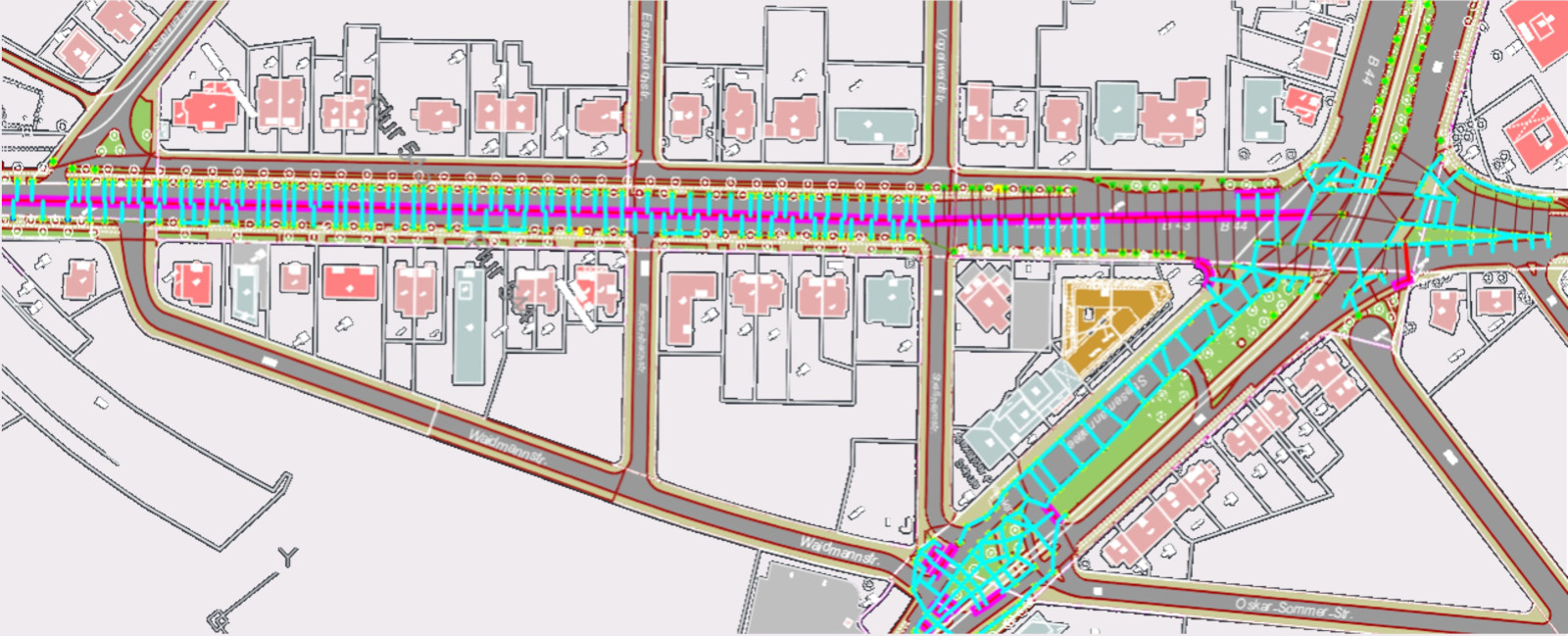
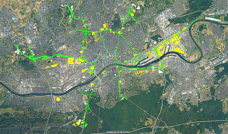
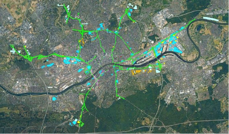
An exemplary land use plan has already been created by the Altes Neuland Frankfurt Foundation

Stiftung Altes Neuland Frankfurt / GNU

An exemplary land use plan has already been created by the Altes Neuland Frankfurt Foundation

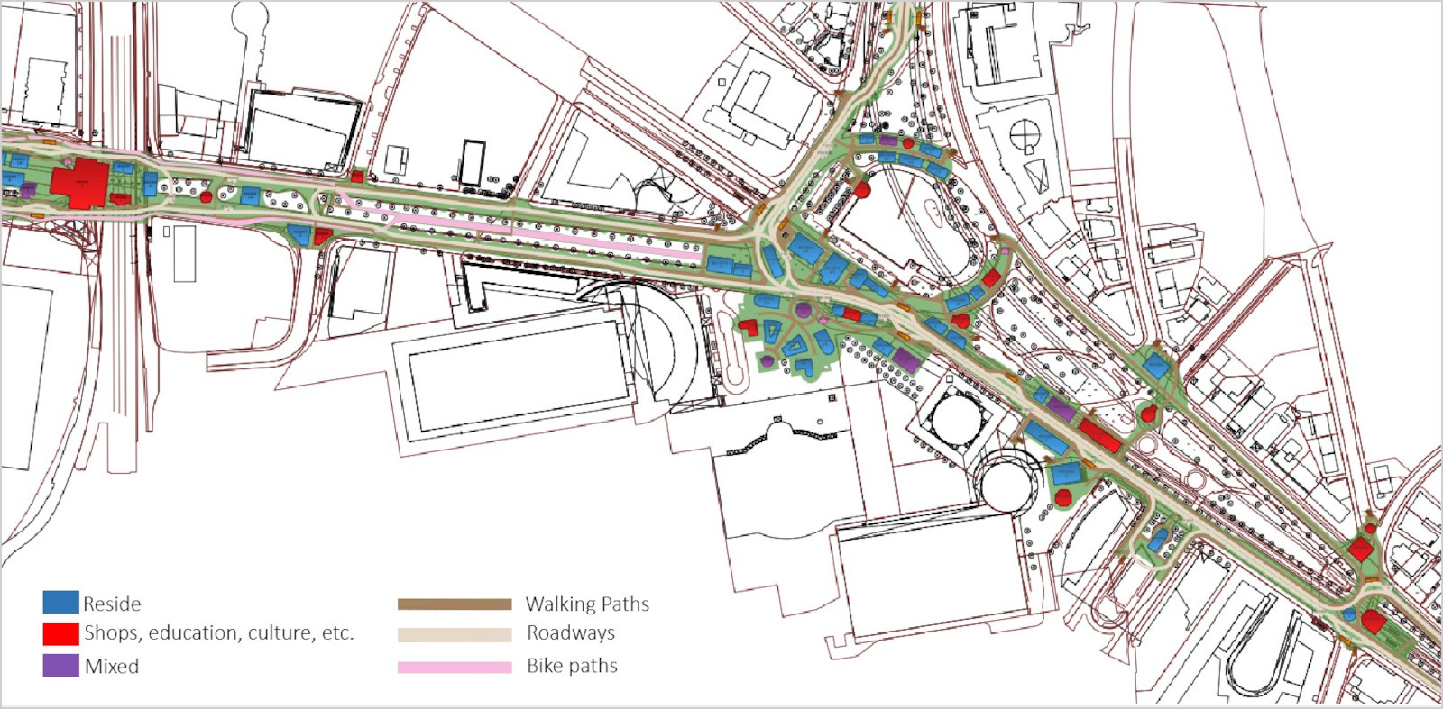
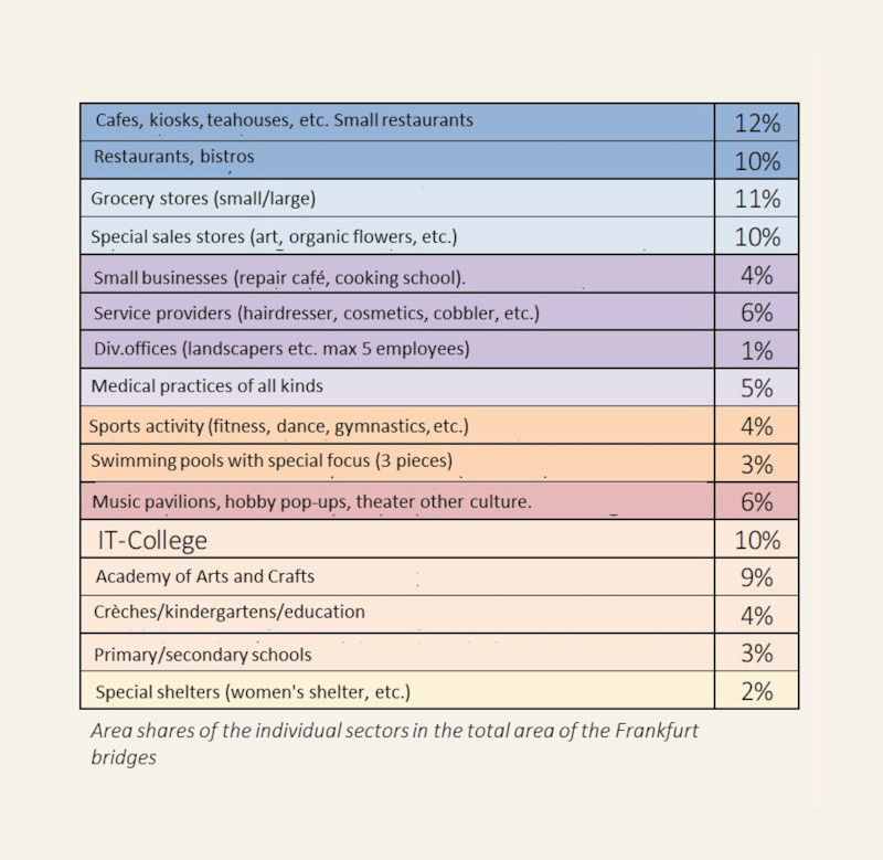
•The proposal for the use of the land has been planned into the urban land map of the city of Frankfurt: Areas for traffic have been defined as well as green areas, construction windows for buildings and the type of use of the buildings.

Stiftung Altes Neuland Frankfurt / GNU

Community-oriented planning company central to development plans requiring approval

§It performs the coordination with all stake-holders

§At the city level: City councillors, local advisory councils, all departments, Netzdienste Rhein Main (NRM), Mainova, Stadtentwässerung Frankfurt (SEF), Frankfurter Entsorgungswerke (FES), Verkehrsgesellschaft Frankfurt (VGF), Frankfurter Behinderten-Arbeitgsgemeinschaft (FBAG), Bauamt, Branddirektion, Wasserstraßen- und Schiffahrtsamt and others.

§At the state level: Hessian Parliament, Hessian ministries, Hessian state offices (especially HLNUG and Hessen Mobil)

§Citizens' initiatives, clubs, associations (especially Chamber of Crafts and Chamber of Industry and Commerce)

§Higher education institutions and research institutes in Frankfurt and Hesse ( = stakeholder for Frankfurt Bridges as a showcase for innovations and Frankfurt as an innovation center in Europe)


It deepens the promotion of all social concerns on the basis of the study of the foundation Altes Neuland Frankfurt

-Affordable housing ̶ Sustainable transport ̶ Promotion of art and culture

-Urban energy transition ̶ Environmental protection, biodiversity ̶ Inclusion

-Water-sensitive city ̶ Social facilities         


It drafts the land use plan on the basis of the land use proposals in the bridge master plan of the Old New Land Foundation Frankfurt

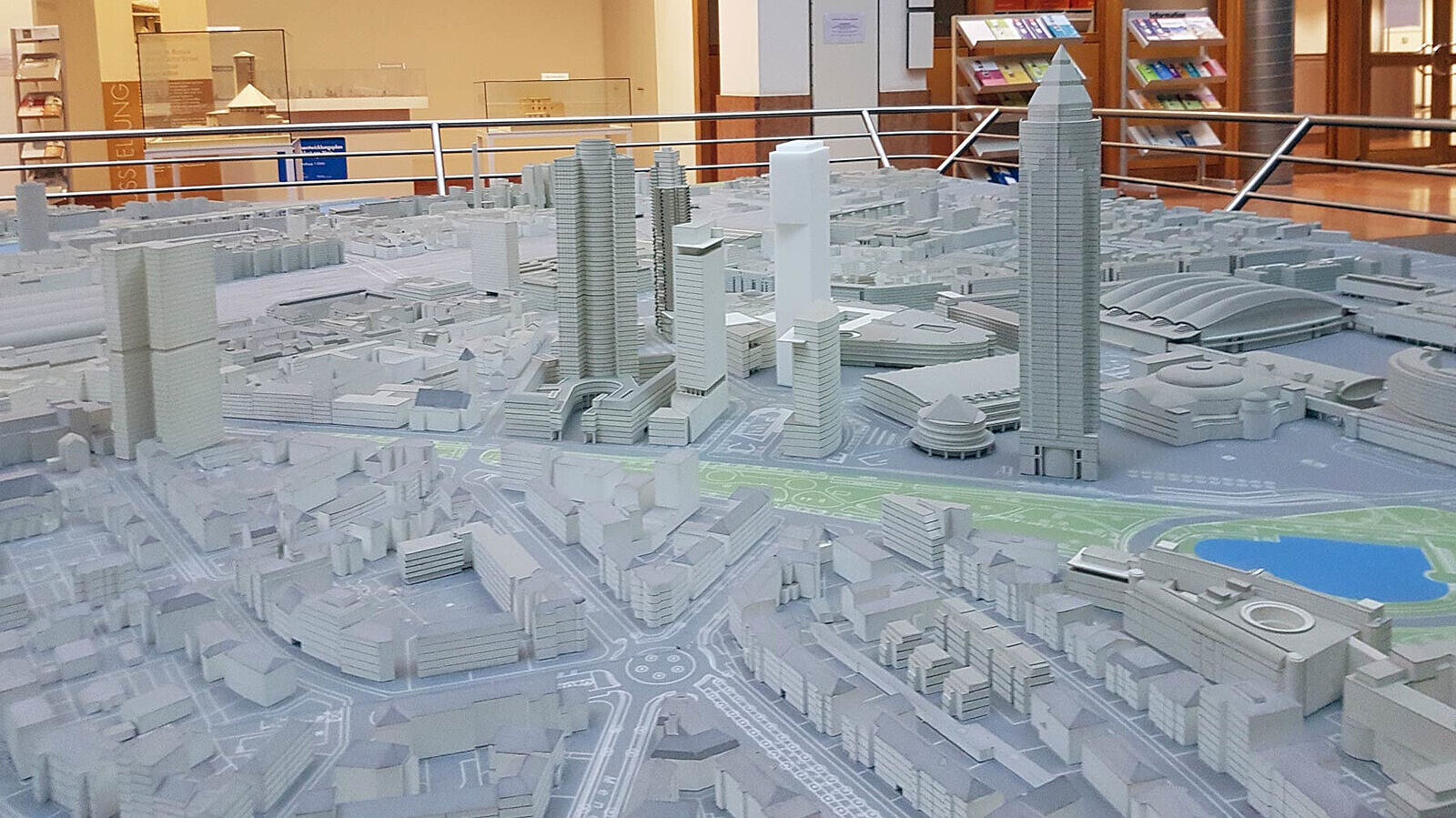
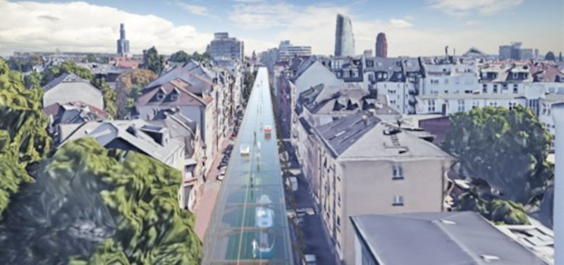
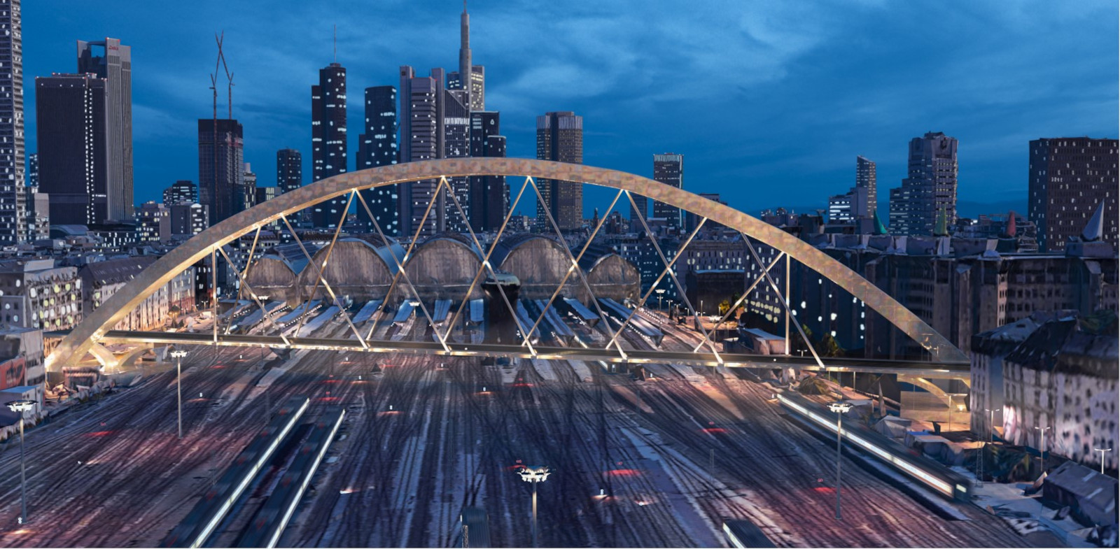
The following design plan - the "master plan" - of the entire bridge surface already gives a precise picture of the: "Frankfurt bridges

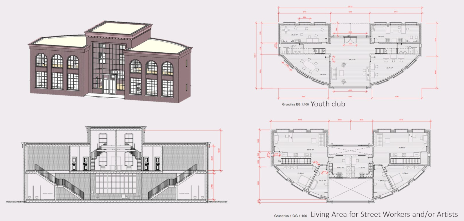
During the preliminary phase for the actual start of planning, the bridge corpus is already planned together with the building cubatures. In the design phase, the following details are added:

-The architectural style is determined for all quarters

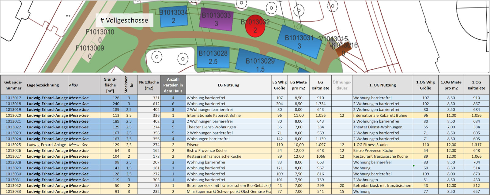
-All buildings are attributed a final use

-Revit drawings are made for all buildings on this basis

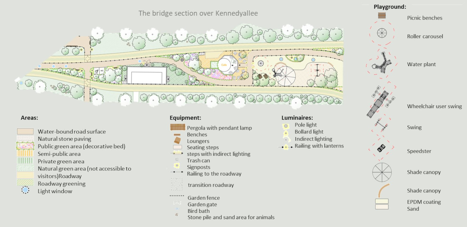
-The landscape architectural design of the entire bridge is worked out

-Within the framework of which also takes place a detailed description and calculation of lighting

-as well as the planning of all accesses to the bridges: Elevators, stairs, escape stairs

-For public green areas, the types of use are specified.

-Furthermore, all green areas - public as well as private - will have their planting defined in the course of the landscape architectural design.
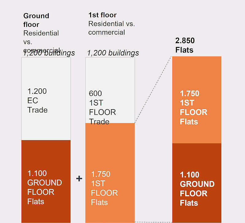
The design planning or master plan is based on the templates of the Altes Neuland Frankfurt Foundation, which has carried out a similarly detailed design for sections of the Frankfurt bridges as an example within the framework of the feasibility study. The design phase will last one to two years.
Stiftung Altes Neuland Frankfurt / GNU

Design phase completes plan contents of the present SANF feasibility study.

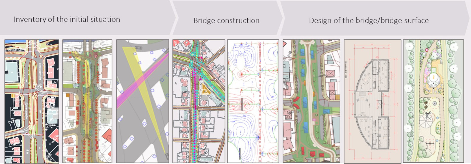
In the feasibility study, the most important steps of the preliminary planning were gone through for some neighborhoods:

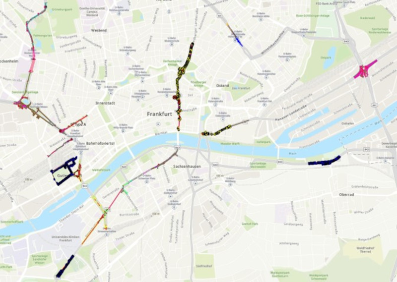
1.Determination of the georeferencing framework parameters as a basis for planning

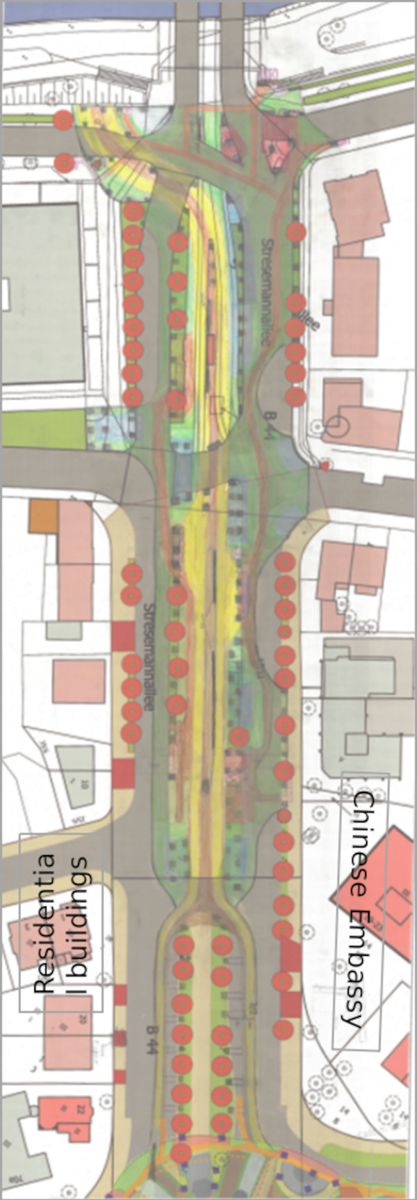
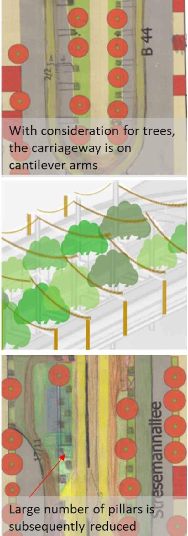
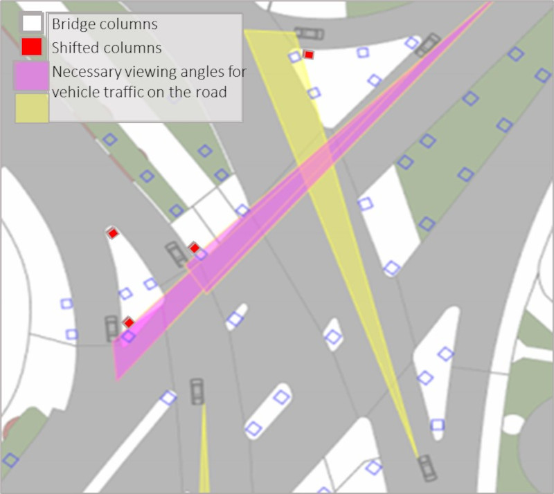
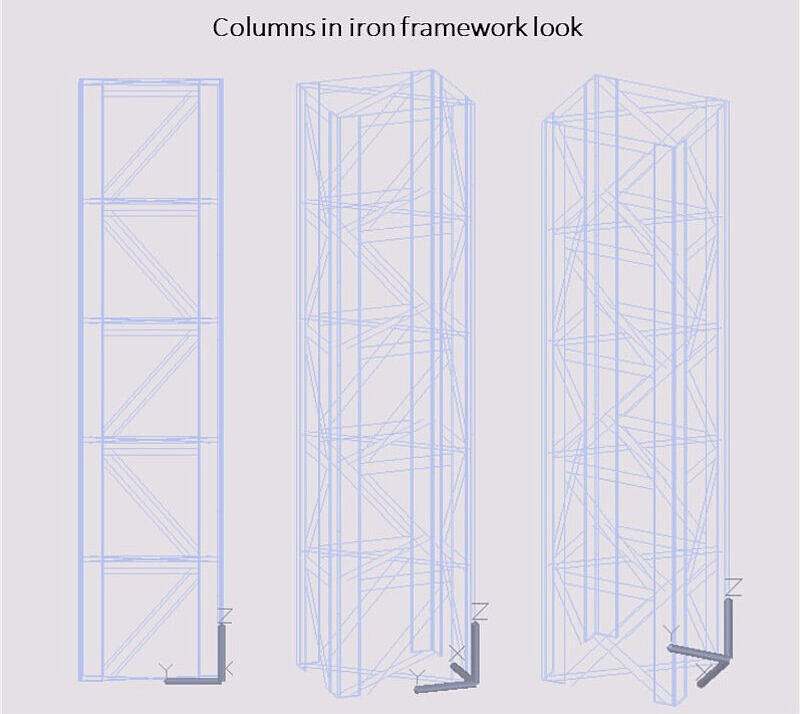
2.Route and column positioning taking into account trees, driveways, escape routes, sight lines etc.

3.Thereby: Incorporation of the medium and long-term traffic planning of the city of Frankfurt - as far as known.

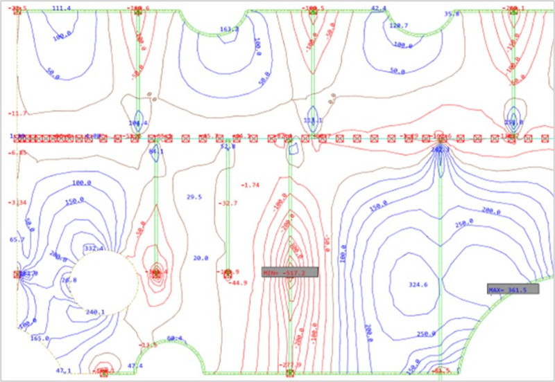
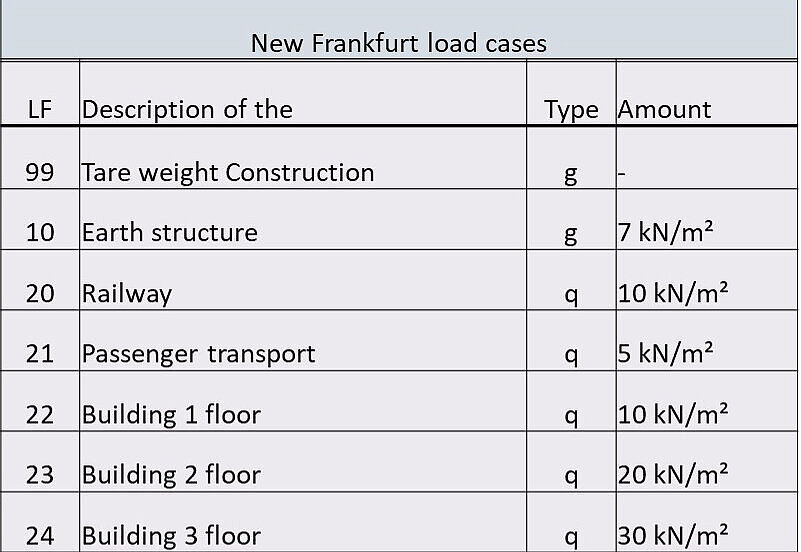
4.Statics and load maps per course section

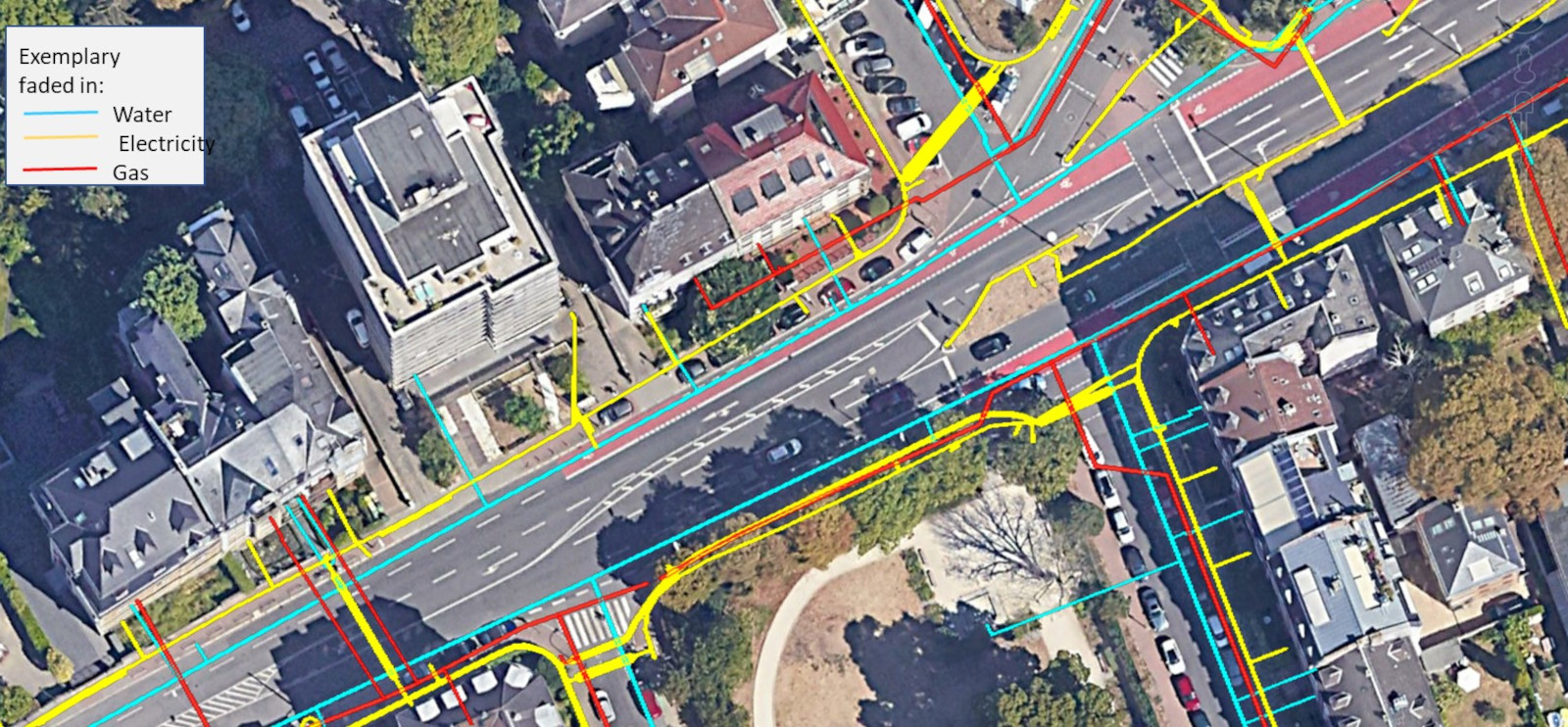
5.Analysis of intersections of column piles with utility lines in the ground.

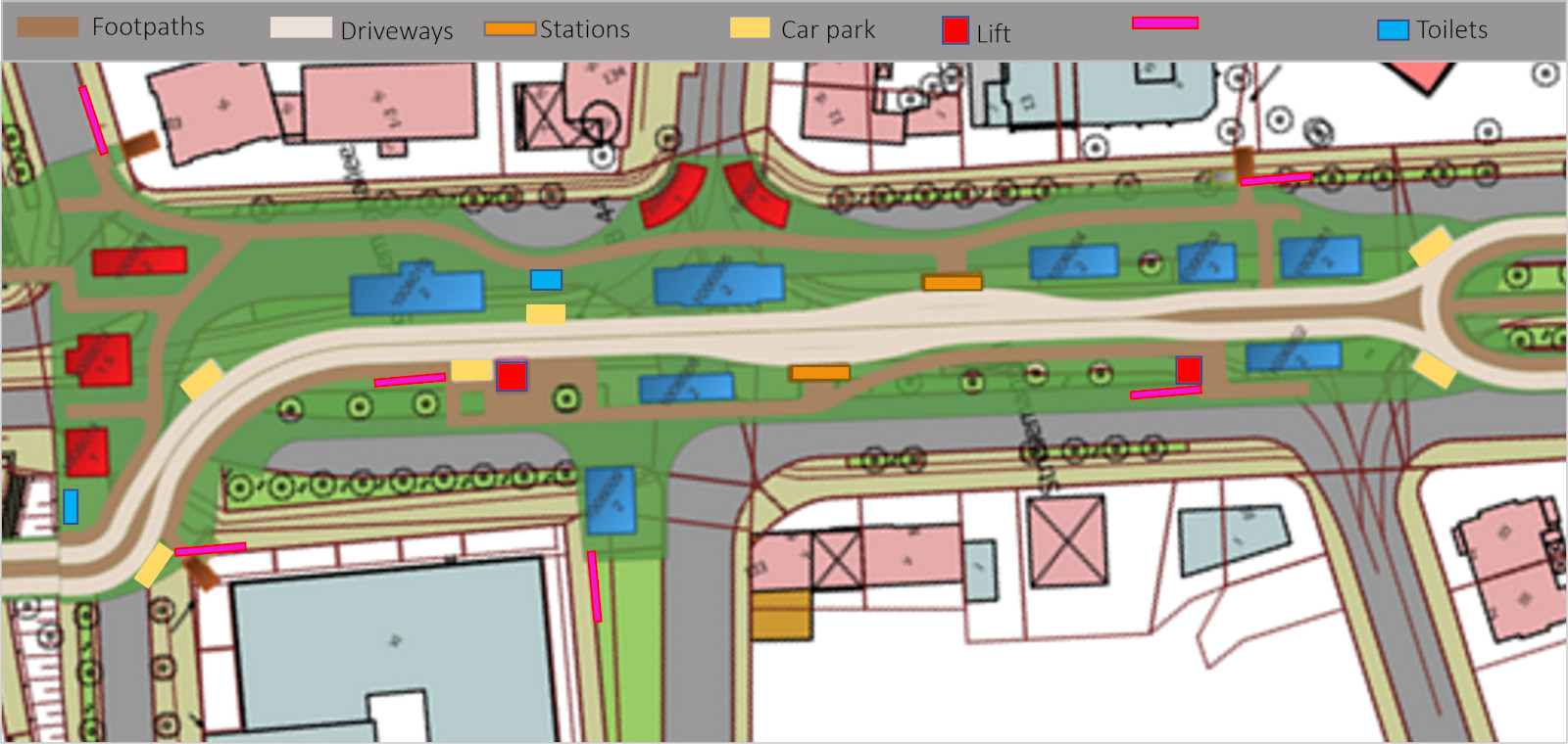
6.Revit design of the bridge, including accesses (stairs, elevators), walkways/driveways, parking and stations.

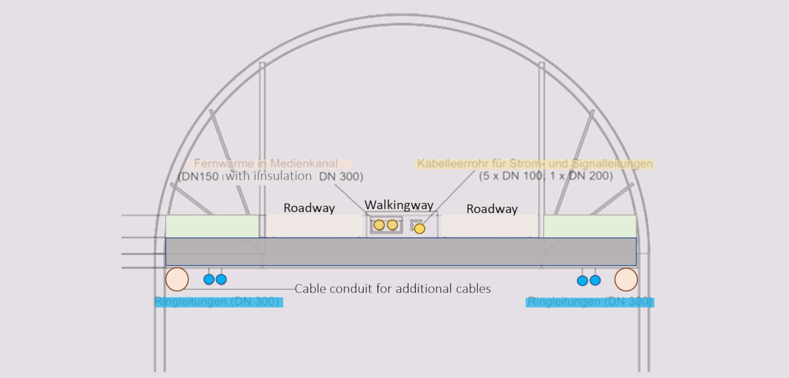
7.Piping plan for all bridge pipelines across the entire bridge route

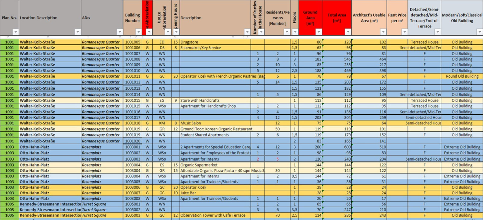
8.Buildings per quarter section in Revit (incl. floor plans) as well as supply centers at the bridges

9.Shading analysis and resident analysis for the entire course

10.Landscape architectural design of sections in Vectorworks (incl. lighting, park benches, Renomat roundels, etc. )

11.Review "architectural master plan" (consisting of constructive architecture part in Revit and landscape architecture part in Vectorworks).

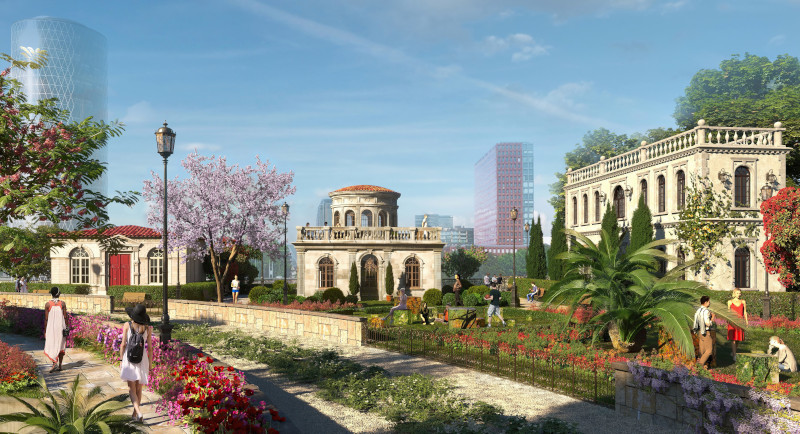
12.If applicable, exemplary visualizations to get an idea of each neighborhood.

13.Capture of all integrable structures along bridges: Roofs for solar panels and rainwater harvesting, waste heat harvesting from data centers and industry.

14.Design of all underground structures along the bridge: Cisterns, energy storage tanks, probe fields.

The "Frankfurter Brücken" as a beacon of ESG and common good oriented urban renewal

Infrastructure projects or major construction projects in Germany often meet with resistance from the population - usually with justified reasons: Either they entail harmful aspects for the environment or they affect people in whose immediate vicinity the project will take place.


The Frankfurt bridges massively promote environmental protection, which actively addresses, implements and respects typical concerns about large infrastructure projects:

•Unique stepping stone biotopes for animals and plants are created

•Of the 2 million square meters of bridge surface, 1 million square meters is vegetated, with a large proportion of protected areas that provide habitat for countless animal and plant species as wild meadows

•The construction of the bridges is exemplary for all future infrastructure projects: Nesting and sheltering opportunities for animals are included in the design from the outset; excavated material from the construction site is used to fill hills that act as a nature conservation reservoir (instead of being transported to other regions with high CO2 emissions).

•The body of the bridge is made of various types of eco-concrete for research purposes

•The urban energy transition, like the concept of the "water-sensitive city," can be realized in the midst of existing buildings, giving adjacent urban areas the opportunity to become more sustainable and green.


People who are adversely affected by the bridges, primarily through shading, receive attractive compensation:

•Depending on the degree of shading, the allocation of annual shading rights for owners and tenants is envisaged. These can be traded and entitle either to purchase into the ownership company at a more favorable or fixed future option price, can be exchanged for occupancy rights in the rental apartments being created, or will be bought back by the ownership company as part of market pricing

Unlike many wind power projects, here the consenting party is to benefit permanently and annually from its consent